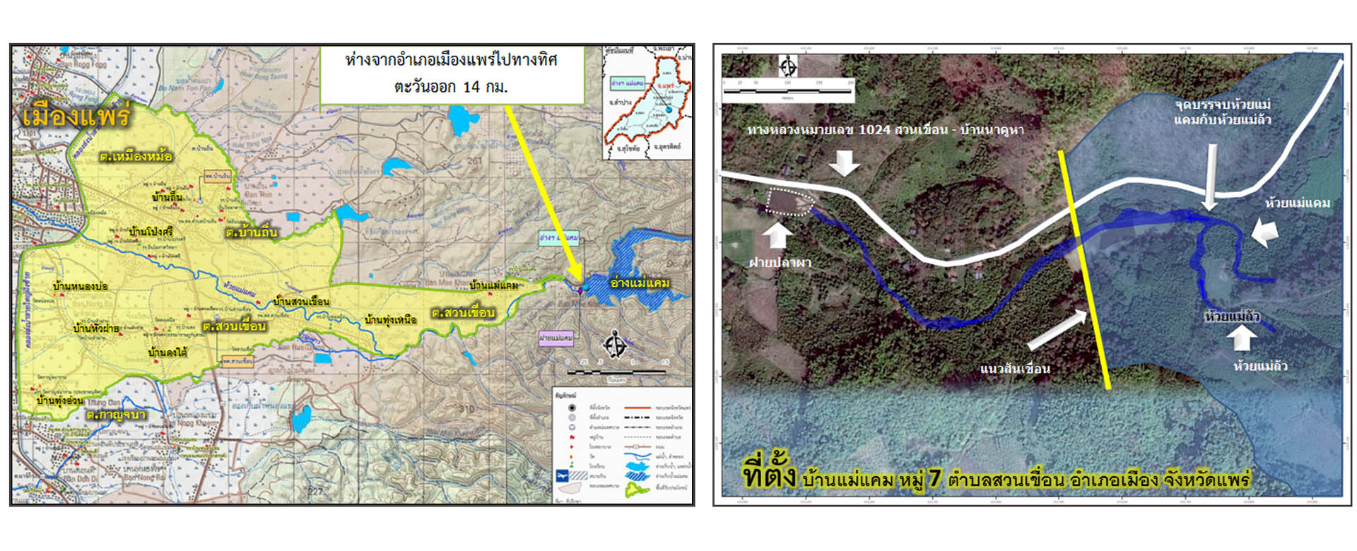
Environmental Impact Assessment (EIA) study of Mae Kaem Reservoir (focused on replacement road) to be used for detail design and construction process. The structure of the reservoir consists of catchment area 59.00 km2, length of the river from the upstream to the earth dam 16 km., width of dam 9 m., length of dam 358.563 m. the highest of the dam is 34.2 m., the maximum width of the dam base is 210 m. The amount of soil embankment is about 716,000 m3, having river outlets as water delivery system pass through the existing river to the mine. Reservoir capacity; retention water level is 8,500,000 m3, maximum water level is 9,700,000 m3, benefit area is 7,500 rai.
The following tasks were undertaken:
| Name of Project | Consultancy Services for Environmental Impact Assessment (EIA) Study of Mae Kaem Reservoir Project, Phrae Province |
| Location | Baan Mae Kaem, Moo 7, Suan Kuean Subdistrict, Muaeng District, Phrae Province |
| Client | Royal Irrigation Department |
| Duration | October 2015 – December 2016 |
| Project Cost |
© 2020 Seatec Group. All Rights Reserved.
Designed by A Must